
Los Angeles · 3D Scanning Services
Drone Mapping in Los Angeles
FAA-licensed drone flights that turn a site into orthomosaic maps, surface models, contours, stockpile volumes and 3D point clouds.
Drone Mapping · Los Angeles
Aerial Maps and Models of Your Site
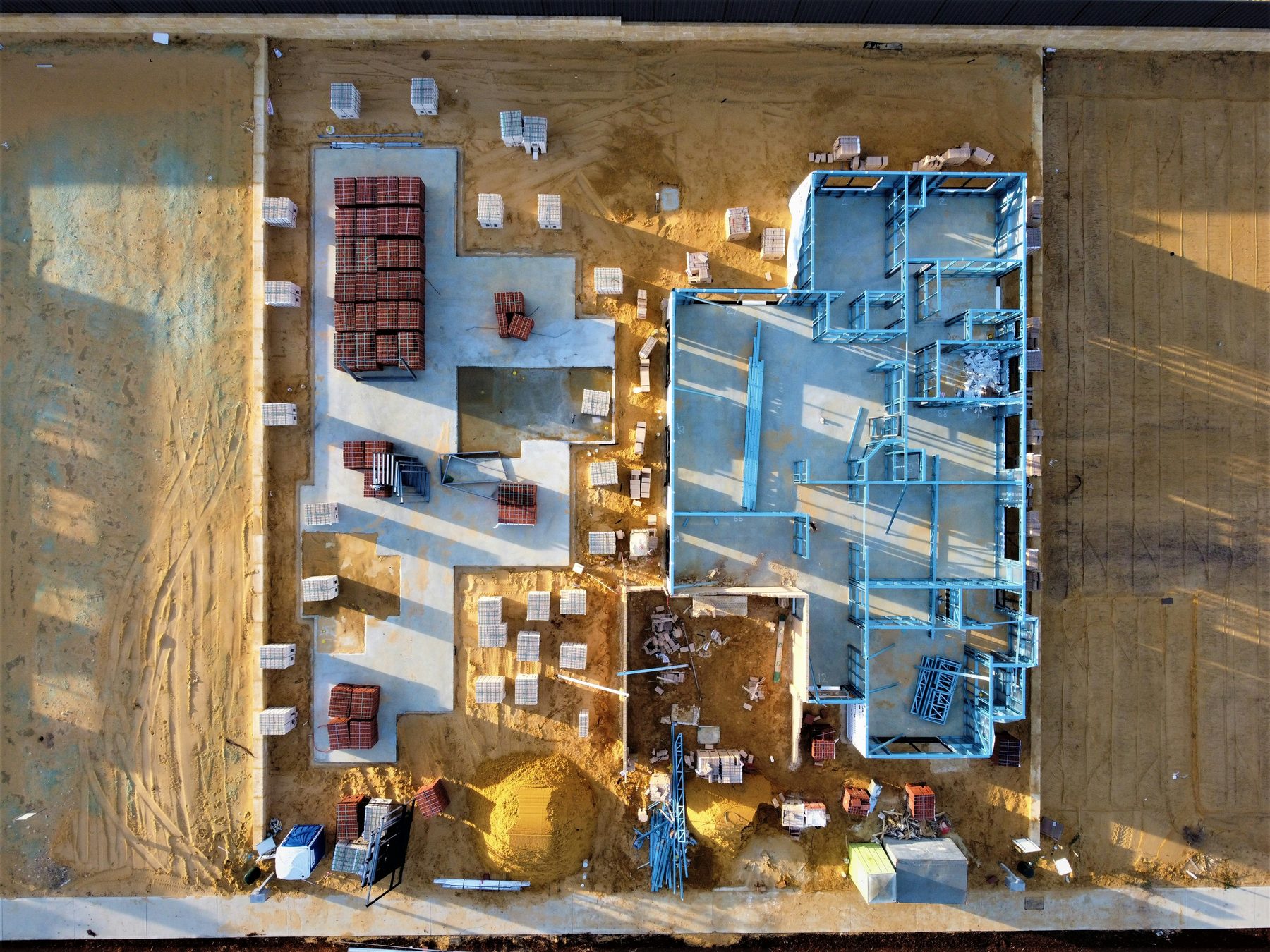
Drone mapping means flying a drone in a set grid over a property, taking hundreds of overlapping photos or lidar passes, and processing them into measured maps and 3D models. For Los Angeles builders, developers, engineers and property owners, one flight can cover acres that would take a ground crew days. You get an orthomosaic, which is a single, scaled aerial image you can measure from, plus a surface model, contour lines, a point cloud and volume reports for stockpiles or cut and fill. Our pilots hold FAA Part 107 remote pilot certificates and handle the airspace approvals that most of the LA basin requires.
Flights Planned Around LA Airspace
Much of Los Angeles sits under controlled airspace around LAX, Burbank, Long Beach, Van Nuys, Santa Monica and several smaller airports. Flying there legally takes an FAA authorization, often through LAANC, and some sites near busy runways need a longer request through FAA DroneZone. We check the airspace for every address before we quote, and we tell you up front if a site needs extra lead time. Stadium flight restrictions, such as the ones around SoFi Stadium on game days, and local rules like the City of Los Angeles ban on flying in city parks without a permit are part of the same check. On the ground, we pair the drone data with laser scans of the structure itself when a job needs both the site and the building.
- FAA Part 107 licensed pilots
- Orthomosaics, contours and 3D site models
- Stockpile volumes and cut-fill reports
- LAANC and FAA airspace approvals handled
When a Drone Survey Makes Sense
These are the jobs where drone mapping saves the most time.
Site planning before design
Architects and civil engineers need a current picture of the land, trees, driveways and neighboring buildings. An orthomosaic and surface model give them a scaled base in days.
Earthwork and grading
Contractors use repeat flights to track cut and fill against the grading plan and to back up quantities on pay applications.
Stockpile and material volumes
Aggregate yards, recycling sites and large job sites measure stockpiles from the air without anyone climbing them. Volume reports come back with the date of the flight.
Monthly progress from above
Owners and lenders like an aerial view of the whole site each month. Flights on the same grid make side-by-side comparisons easy.
Roofs and large properties
Big roofs, campuses, hillside lots and industrial yards are hard to measure from the ground. A flight records roof equipment, drainage and site layout in one visit.
Send the address and the size of the area, and we will check the airspace and suggest a flight plan. Call: (310) 844-0354

How We Work
Every project follows the same basic path from the first call to the files on your server:
1. Check airspace and plan
We review the airspace, request any FAA authorization, plan the flight grid and decide where ground control points go for the accuracy you need.
2. Set control and fly
Our crew sets and measures ground control, flies the grid with a visual observer when needed and checks coverage before leaving the site.
3. Process and deliver
Photos or lidar data are processed into maps, models and reports, checked against the control points and delivered in the formats your team uses.
Drone Mapping Deliverables
Orthomosaic maps
A single, scaled aerial image of the site, delivered as a GeoTIFF that drops into CAD and GIS software. You can measure distances and areas right on it.
Surface models and contours
A digital surface model shows the height of everything the drone saw, and contours can be generated at the interval you need and delivered as DWG or DXF.
Point clouds and 3D meshes
Dense point clouds in LAS or LAZ format and textured 3D meshes give designers a 3D view of the whole site, including nearby buildings.
Volume and cut-fill reports
We measure stockpiles and compare surfaces between flights or against a design grade, with a short report showing quantities and dates.
Ground control for accuracy
Measured ground control points and RTK positioning tighten the accuracy of the maps. When a project needs a certified topographic survey, a licensed land surveyor provides it, and we tie our flights to their control.
Cost of Drone Mapping
Most drone mapping jobs in Los Angeles run $800 to $3,500 per flight, depending on acreage, accuracy and deliverables. Repeat flights on a schedule cost less per visit. What changes the price:
- Site size. A single lot flies in minutes, while a large campus or grading site can take several flights.
- Accuracy. Ground control points and RTK add setup time but give much tighter results.
- Airspace. Sites near runways may need longer FAA requests or flights at set times.
- Deliverables. An orthomosaic alone costs less than contours, volumes and a 3D mesh together.
- Lidar or photos. Lidar sees through light vegetation and costs more than photo mapping.
- Flight schedule. Monthly or weekly programs are priced lower per flight.
Share the address and what you need, and we will send a written quote after checking the airspace.
Frequently Asked Questions
Can you fly a drone anywhere in Los Angeles?
No. Much of the area is controlled airspace, and some places, such as stadiums during events and City of Los Angeles parks, have extra limits. We check every address and get the needed authorization before we fly.
How accurate is drone mapping?
With ground control points or RTK, maps are often accurate to a few centimeters. Without control, measurements are good relative to each other but less exact on absolute position. We state the expected accuracy in the quote.
Is a drone map the same as a topographic survey?
Not always. A drone map is a strong planning and progress tool, but a certified topographic survey in California must come from a licensed land surveyor. We can work with your surveyor and tie to their control.
How long does a flight take?
A single lot may take less than an hour on site, including setup. Large sites can take most of a day. Processing usually takes a few working days.
What file formats do you deliver?
Orthomosaics as GeoTIFF, contours as DWG or DXF, point clouds as LAS or LAZ, and volume reports as PDF. Tell us your software and we match it.
Do neighbors need to be told about the flight?
It is a good idea on residential streets. We fly the planned grid over your property, avoid crowds and follow FAA rules on flying over people.
Can weather cancel a flight?
Strong wind, rain and low marine layer can delay a flight. We watch the forecast and reschedule at no charge when conditions are not safe.
Need a Building or Site Scanned?
Tell us the address, the size and the deliverable you have in mind. We will send a written scope and price.
Or call us now: (310) 844-0354